


News
-
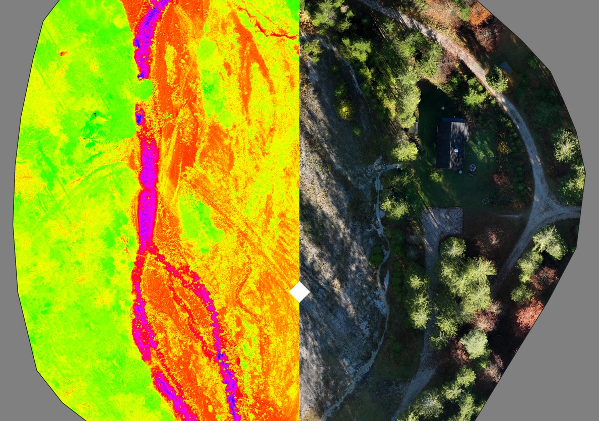
Multispectral survey of an alpine stream
Below you can see the result of a drone image taken with a multispectral camera. A high-resolution orthomosaic with a…
-

Publication in Carinthia II
Under the leadership of Gregory Egger, I worked on a Google Earth Engine model that enables the semi-automatic classification of…
-
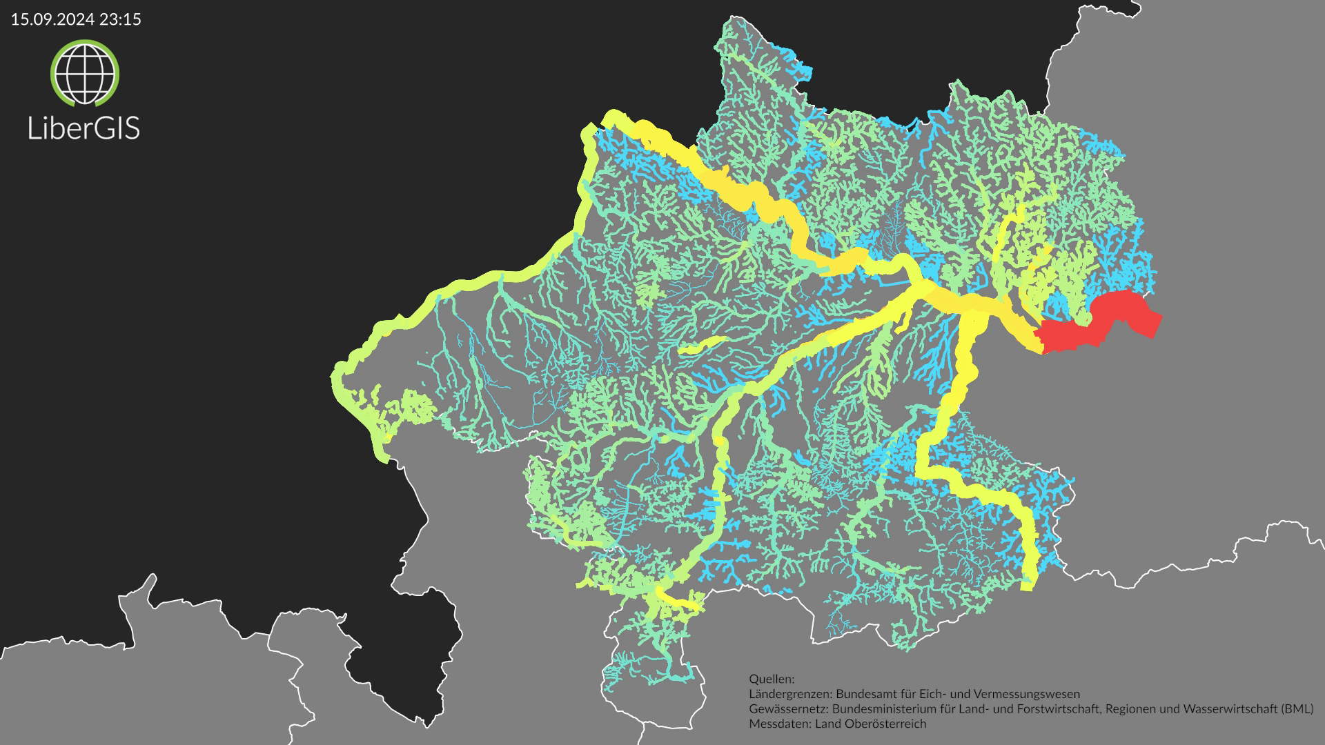
Visualization of 2024 flooding
The floods in September 2024 were one of the most dramatic weather events I can remember, especially in northeastern Austria.…