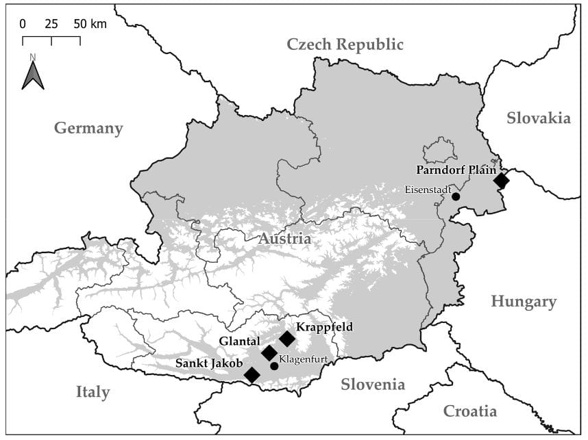
News
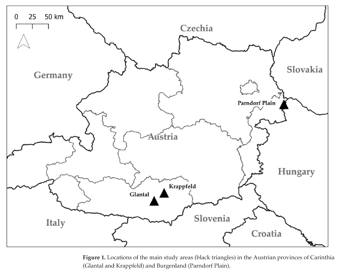
Maps for the Hen Harrier
I was able to contribute a few simple maps for a publication by Remo Probst. The article deals with the…
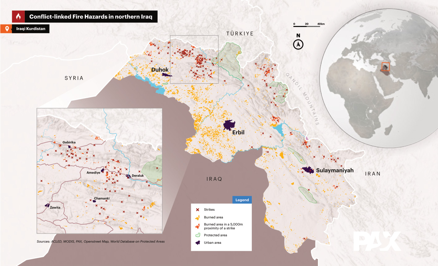
Contribution to NGO work
As a GIS expert, I analyzed satellite images to detect burned areas in Iraq. This work was part of a…
Multispectral survey of an alpine stream
Below you can see the result of a drone image taken with a multispectral camera. A high-resolution orthomosaic with a…
Publication in Carinthia II
Under the leadership of Gregory Egger, I worked on a Google Earth Engine model that enables the semi-automatic classification of…
Visualization of 2024 flooding
The floods in September 2024 were one of the most dramatic weather events I can remember, especially in northeastern Austria.…
DJI Mavic 3M Drone
My DJI Mavic 3M drone with multispectral-camera is used to professionally survey large areas of the landscape. Images and video…
The first folder
Finally I received my first promotional folder. I can now start handing these out and I’ll also send them to…
My first business cards
Today I recieved my first business cards for my own company LiberGIS! The cards are made from 300g recycled paper…