

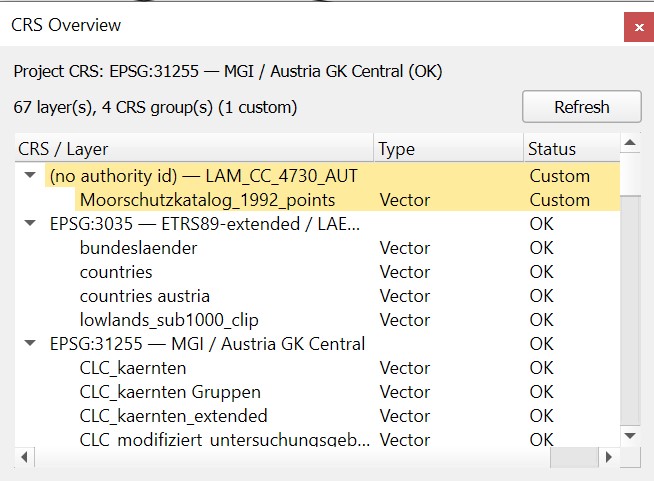
If you’ve worked a lot with ArcMap, you probably know the view that lists all layers grouped by their coordinate reference system (CRS). It’s handy for making sure all your layers line up and for spotting incorrectly defined CRSs.
QGIS doesn’t have a view like that out of the box, so I put together a plugin that does: CRS Overview
You can install it directly through the QGIS Plugin Manager (make sure “Show also experimental plugins” is enabled).
https://plugins.qgis.org/plugins/crs_overview/
More details HERE.